


Almost the whole of the southern section (Stainmore to Craven) of the Northern Pennine Orefield is within the Your Dales Rocks Project Area. Over 50 minerals occur within the area of which galena (lead), and smithsonite (zinc) were the principal economic minerals. Baryte and fluorite, which were initially thought of as uneconomic or gangue minerals by the early miners were worked more recently. Small quantities of fluorite are still worked today at Hanson’s Pateley Bridge limestone quarry.
Mapping by the BGS has identified almost 1000 vein elements, with over 600 major veins. Over 500 of the veins occur in the strata of the Yoredale Group (Alston and Stainmore Formations), particularly the Main Limestone and Main Chert, 370 of which are located in the North Swaledale section of the orefield. The other main area is Grassington Moor – Greenhow. In both areas mining mainly took place in the late 18th century and most of the 19th century.

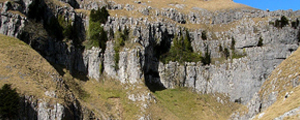
Photo: The Greenhow Rake Vein at Greenhow Quarry

Photo: Galena (lead ore)

Photo: Fluorspar

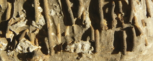
Photo: Calcite

Photo: Barytes
It is not known when the mineral resources of the area were first exploited; finds of lead pigs of Roman date suggest a local lead industry but no definite pre-medieval lead workings have yet been identified. Lead mining, particularly for roofing castles, cathedrals, churches and abbeys, flourished from the twelfth century AD only to decline temporarily after the Dissolution of the Monasteries brought large quantities of recycled lead onto the market. Lead mining reached its peak in the first two thirds of the nineteenth century.
In many areas, including Swaledale and Arkengarthdale, Greenhow and Grassington Moor it has produced a distinctive mining landscape marked by abandoned shafts, adits or levels, and spoil heaps. The position of shafts is a good indicator of the course of underground veins. The minerals found on spoil heaps can be important evidence for the process of mineralisation and are often now the only accessible evidence for activities which took place deep underground. The most dramatic mining landscapes are formed where a mineral vein outcrops on a steep valley side and was worked by hushes, a form of opencast working which used water to scour the soil and wash away broken rock which accumulated on the floor of the hush. Hushing was used extensively in the Swaledale and Arkengarthdale areas in the late 18th and early 19th centuries and good examples of hushes can be seen in Gunnerside Gill and Arkengarthdale.
Although lead was the principal ore worked, copper and zinc (smithsonite or calamine) were worked, between 1788 and 1830, at the Pikedaw mine near Malham.
The North Swaledale Orefield continues into the north west of the Vale of York, and mining occurred at a similar time to that further west. The area around Middleton Tyas, especially the Black Scar Quarry, was notable for the most extensive production of copper.

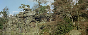
Photo: Fell End, Slei Gill, Arkengarthdale illustrates the impact of lead mining on the landscape © Yorkshire Dales National Park Authority

Map: The distribution of mineral veins in the Your Dales Rocks Project Area

Map: The distribution of historic lead mines in the Your Dales Rocks Project Area